STAGE 1 - Brescia, Collebeato, Cellatica, Concesio, Gussago
- Start: Brescia
- Arrival: Gussago
- Total Length: 20,8 km
- Difficulty by Foot: Medium
- Climb up: 700 m
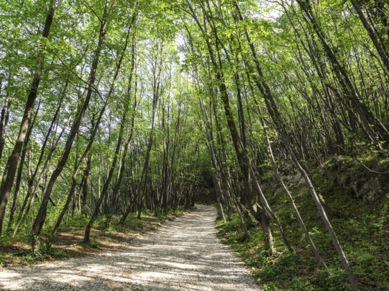
This first stage is a journey through Brescia's history that leads straight to the city's green lung, Monte Maddalena, and then further into the enchanting Valle di Mompiano, from which you continue into the province, passing through the towns of Collebeato, Concesio, Cellatica and Gussago. The start is the Capitoline Temple, then you pass through the striking Museum complex of Santa Giulia, a UNESCO World Heritage Site and certainly worth a visit.
The first short climb takes you inside the city fortress, Brescia’s Castle, called the Falcon of Italy, a medieval beauty perched on Cidneo Hill. From there, via the ancient Strada del Soccorso trail (HERE ARE THE INSTRUCTIONS TO TAKE IT), carved into the living rock on the northern slopes of the hill and used in ancient times by soldiers to exit and enter the fortress, you arrive in Via Pusterla. Here, the route leaves the historic centre and starts the ascent to Monte Maddalena, in the natural context of Parco delle Colline di Brescia, a park encompassing multiple municipalities. Following Trail No. 7, you pass the Church of San Gottardo, Cascina Margherita farm, and arrive, after a steep descent, to the enchanting Valle di Mompiano and its namesake mountain hut.
Stage 1 continues around San Giuseppe hill and reaches Villaggio Prealpino which houses the Church of Santa Giulia, the final stage of the route called Cammino di Santa Giulia.
From Villaggio Prealpino, you proceed toward the town of Collebeato and, after crossing the historic centre, you re-enter Parco delle Colline until you arrive at the former Benedictine Monastery of Santo Stefano, dating back to the 15th century. A place that deserves to be brought back to life, hopefully also thanks to the contribution of the wayfarers.
From Collebeato, it is possible to make a detour to reach the viewpoint where the Giant Bench is installed, while the official route proceeds to the Shrine of Madonna della Stella and merges into the trail called Sentiero 3V. Finally, through Sentiero delle Croci, you descend toward the historic centre of Gussago. On the right, don't miss the Church of San Rocco, a little gem that is well worth a visit.
POIs: Santa Giulia Museum Complex, Capitoline Temple, San Salvatore Church (UNESCO World Heritage Site), Brescia Castle, Santo Stefano Monastery, Madonna della Stella Shrine, San Rocco Church.
Natural POIs: Parco delle Colline, Monte Maddalena, Valle di Mompiano.
Municipalities crossed: Brescia, Collebeato, Cellatica, Concesio, Gussago
ROUTES CROSSED: Sentiero 3V – Cammino di Santa Giulia.
Strada del Soccorso variant. Strada del Soccorso is open from 7 a.m. to 8 p.m. For those leaving before 7 a.m. or after 8 p.m., it is necessary to take the road outside the castle that passes through Montagnola, descends to the street called Via Tito Speri and leads to Via Pusterla.
Monte Maddalena variant. For those who are not up to climbing Monte Maddalena and addressing the subsequent steep descent into Valle di Mompiano, an alternative route has been designed. It is marked as ‘Variante Bassa’ (low variant). Full details here.
STAGE 1 - Brescia, Collebeato, Cellatica, Concesio, Gussago


- Start: Brescia
- Arrival: Gussago
- Total Length: 20,8 km
- Difficulty by Foot: Medium
- Climb up: 700 m
This first stage is a journey through Brescia's history that leads straight to the city's green lung, Monte Maddalena, and then further into the enchanting Valle di Mompiano, from which you continue into the province, passing through the towns of Collebeato, Concesio, Cellatica and Gussago. The start is the Capitoline Temple, then you pass through the striking Museum complex of Santa Giulia, a UNESCO World Heritage Site and certainly worth a visit.
The first short climb takes you inside the city fortress, Brescia’s Castle, called the Falcon of Italy, a medieval beauty perched on Cidneo Hill. From there, via the ancient Strada del Soccorso trail (HERE ARE THE INSTRUCTIONS TO TAKE IT), carved into the living rock on the northern slopes of the hill and used in ancient times by soldiers to exit and enter the fortress, you arrive in Via Pusterla. Here, the route leaves the historic centre and starts the ascent to Monte Maddalena, in the natural context of Parco delle Colline di Brescia, a park encompassing multiple municipalities. Following Trail No. 7, you pass the Church of San Gottardo, Cascina Margherita farm, and arrive, after a steep descent, to the enchanting Valle di Mompiano and its namesake mountain hut.
Stage 1 continues around San Giuseppe hill and reaches Villaggio Prealpino which houses the Church of Santa Giulia, the final stage of the route called Cammino di Santa Giulia.
From Villaggio Prealpino, you proceed toward the town of Collebeato and, after crossing the historic centre, you re-enter Parco delle Colline until you arrive at the former Benedictine Monastery of Santo Stefano, dating back to the 15th century. A place that deserves to be brought back to life, hopefully also thanks to the contribution of the wayfarers.
From Collebeato, it is possible to make a detour to reach the viewpoint where the Giant Bench is installed, while the official route proceeds to the Shrine of Madonna della Stella and merges into the trail called Sentiero 3V. Finally, through Sentiero delle Croci, you descend toward the historic centre of Gussago. On the right, don't miss the Church of San Rocco, a little gem that is well worth a visit.
POIs: Santa Giulia Museum Complex, Capitoline Temple, San Salvatore Church (UNESCO World Heritage Site), Brescia Castle, Santo Stefano Monastery, Madonna della Stella Shrine, San Rocco Church.
Natural POIs: Parco delle Colline, Monte Maddalena, Valle di Mompiano.
Municipalities crossed: Brescia, Collebeato, Cellatica, Concesio, Gussago
ROUTES CROSSED: Sentiero 3V – Cammino di Santa Giulia.
Strada del Soccorso variant. Strada del Soccorso is open from 7 a.m. to 8 p.m. For those leaving before 7 a.m. or after 8 p.m., it is necessary to take the road outside the castle that passes through Montagnola, descends to the street called Via Tito Speri and leads to Via Pusterla.
Monte Maddalena variant. For those who are not up to climbing Monte Maddalena and addressing the subsequent steep descent into Valle di Mompiano, an alternative route has been designed. It is marked as ‘Variante Bassa’ (low variant). Full details here.